
These geographical differences have shaped where people live, how cities developed and how different regions of China are connected. They also help explain why travelling across China can feel like travelling between completely different environments.
China’s geography can be understood in several ways. There are broad geographical regions based on landscape and climate, while the country is also divided into provinces and other administrative areas.
Understanding both is useful if you’re studying China, learning Mandarin or planning to travel around the country.
Key Takeaways
- China is one of the world’s largest countries by land area.
- Its landscape includes mountains, plateaus, deserts, plains, rivers and a long coastline.
- Most of China’s major population centres are concentrated in the east.
- China is divided into provinces, autonomous regions, municipalities and special administrative regions.
- Geographical regions and administrative divisions are not the same thing.
- China’s physical geography has had a major influence on its cities, agriculture, transport and regional development.
Where Is China?
China is located in East Asia, on the western side of the Pacific Ocean. It has land borders with 14 countries, including Russia, India, Nepal, Pakistan, and Vietnam.
Its geography is strongly shaped by the contrast between the country’s interior and its eastern coastline. Much of western China is mountainous, elevated and relatively dry, while the east contains broad plains, major river valleys and some of the country’s largest cities.
China also has a long coastline along the Yellow Sea, East China Sea and South China Sea. This coastal position has played an important role in the development of cities such as Shanghai, Guangzhou and Shenzhen, which grew into major centres of trade and industry.
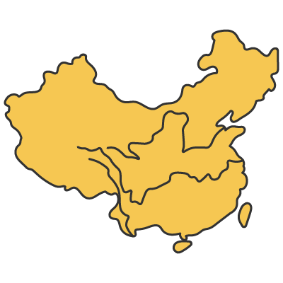
中国
Zhōnguó
China
How Big Is China?
China covers roughly 9.6 million square kilometres, making it one of the largest countries in the world by land area.
Its enormous size means that there is no single “Chinese climate” or landscape. The country stretches across major differences in latitude, elevation and distance from the sea.
In the southwest, the Tibetan Plateau rises to some of the highest elevations on Earth. In the north and northwest, there are large areas of desert and dry grassland. Further east, the landscape becomes lower and wetter, with extensive agricultural plains and densely populated urban areas.
This variety is one of the defining features of Chinese geography. It also helps explain why the experience of living or travelling in Beijing, Shanghai, Sichuan or Tibet can be so different despite all being within the same country.
China’s Major Geographical Regions
There isn’t one official system for dividing China into geographical regions. Different sources may group provinces differently depending on whether they are looking at climate, landscape, economics or culture.
For a broad geographical overview, however, China can be thought of through several large regions:
- North China (北)
- Northeast China (东北)
- East China (东)
- South China (南)
- Southwest China (西南)
- Northwest China (西北)
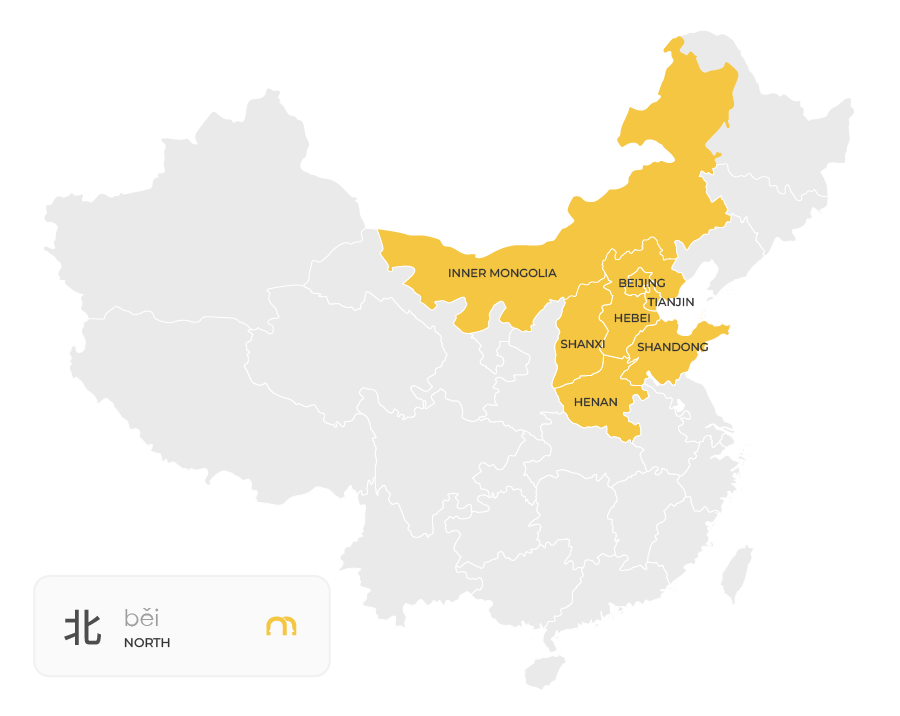
Please use the maps below only for a rough reference. There isn’t one universally accepted way to divide all of China’s provinces into exactly these six regions. The main challenge is the central part of China: provinces such as Henan, Hubei, Hunan, Jiangxi, and Anhui can be grouped differently depending on the classification.
North China
North China includes the area around Beijing and the North China Plain, one of the country’s most important agricultural and population centres.
The region is relatively dry compared with southern China and is strongly influenced by the Yellow River, which has played an important role in the development of northern Chinese civilisation.
Beijing is the region’s most prominent city and serves as China’s capital.
Northeast China
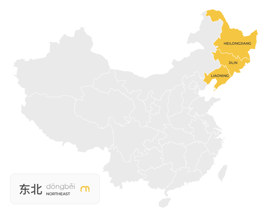
Northeast China includes Liaoning, Jilin and Heilongjiang, an area often known for its colder climate and long winters.
The region contains extensive forests, agricultural land and mineral resources. Its northern location means winters can be considerably colder than in southern and coastal parts of China.
Harbin, the capital of Heilongjiang, is particularly well known for its cold winters and annual ice festival.
Northwest China
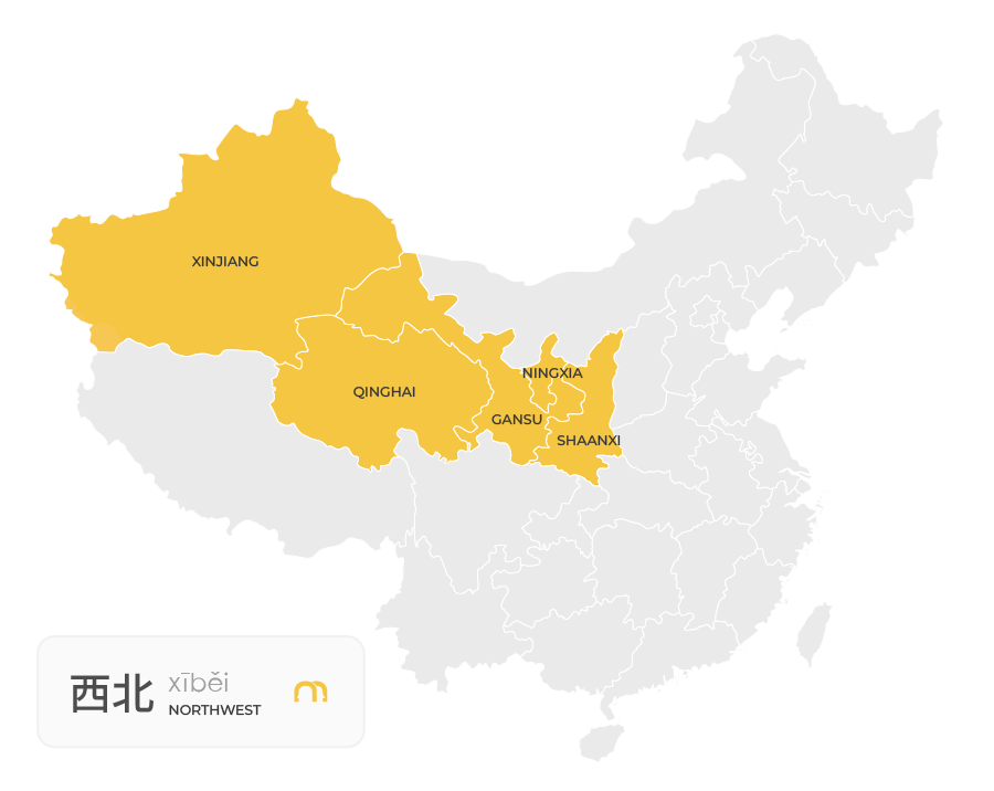
Northwest China is characterised by large deserts, dry grasslands and mountain ranges.
The region includes places such as Xinjiang, Gansu, Qinghai and Ningxia. Xinjiang is home to both the Taklamakan Desert and the eastern part of the Tian Shan mountain system.
Because the region is far from the ocean and contains extensive high terrain and deserts, much of it is considerably drier than eastern and southern China.
East China
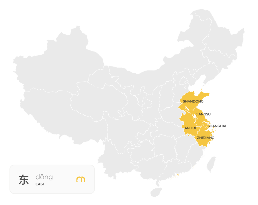
East China contains some of China’s most densely populated and economically developed areas.
The region includes major cities such as Shanghai, Hangzhou and Nanjing, as well as large parts of the Yangtze River Delta.
Its relatively flat terrain, access to waterways and position along the coast have supported agriculture, trade and the development of major urban centres.
South China
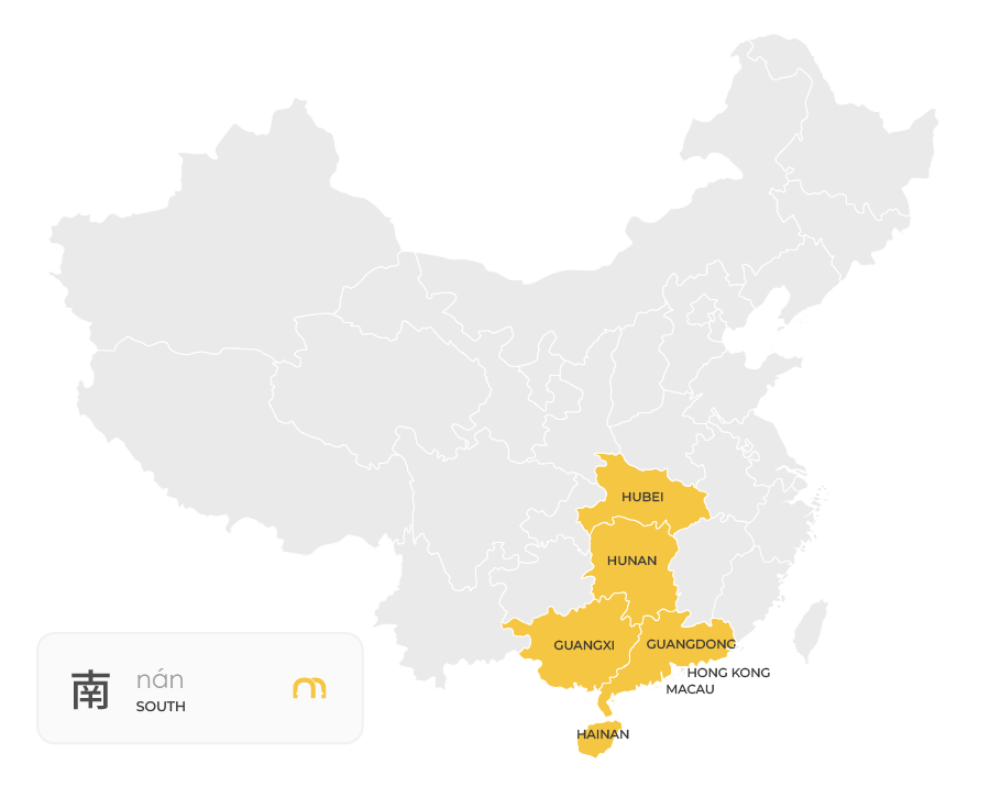
South China is known for its warm climate, subtropical landscapes, and rich food culture.
The region includes Guangdong, Guangxi, Hainan, Hong Kong, and Macau, with tropical beaches, karst mountains, and vibrant coastal cities.
The area has a strong connection to the South China Sea and is home to major cities such as Guangzhou and Shenzhen. Tropical and subtropical conditions also distinguish southern China from the colder north.
It’s also famous for Cantonese cuisine, dim sum, and its strong trading traditions.
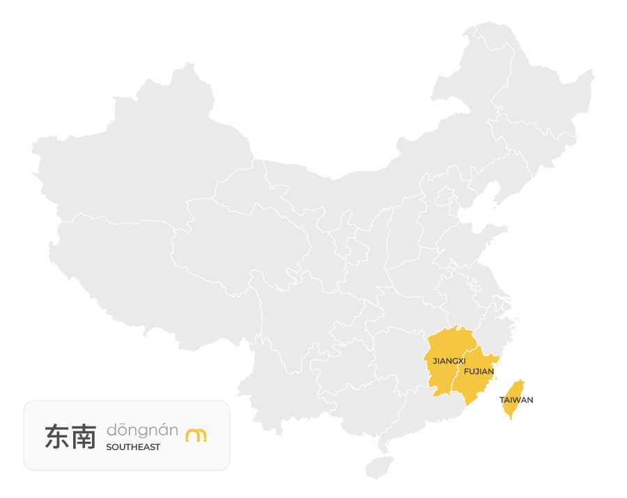
Southeast China
Southeast China is known for its beautiful coastline, historic towns, and rich cultural traditions.
The region includes Fujian, Jiangxi, and Taiwan, featuring dramatic mountains, traditional villages, and coastal landscapes.
It’s famous for Fujian cuisine, tea culture, and unique architecture, including Fujian’s traditional tulou earthen buildings.
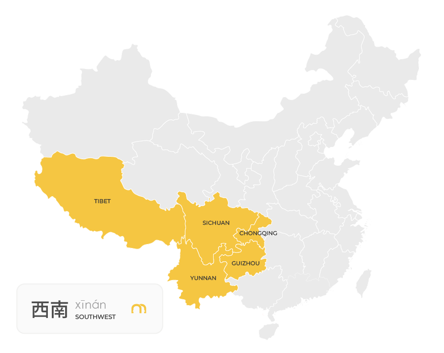
Southwest China
Southwest China is one of the country’s most geographically varied regions.
It includes areas such as Sichuan, Yunnan, Guizhou and Tibet, with landscapes ranging from high plateaus and mountains to deep valleys and basins.
The region also contains some of China’s most dramatic changes in elevation. The Tibetan Plateau, in particular, reaches extremely high elevations and is surrounded by some of Asia’s major mountain ranges.
Provinces and Administrative Divisions of China
When people talk about the provinces of China, they’re usually referring to China’s province-level administrative divisions. These are different from the broad geographical regions discussed above.
China has 34 province-level administrative divisions, divided into four categories: provinces, autonomous regions, municipalities and special administrative regions.
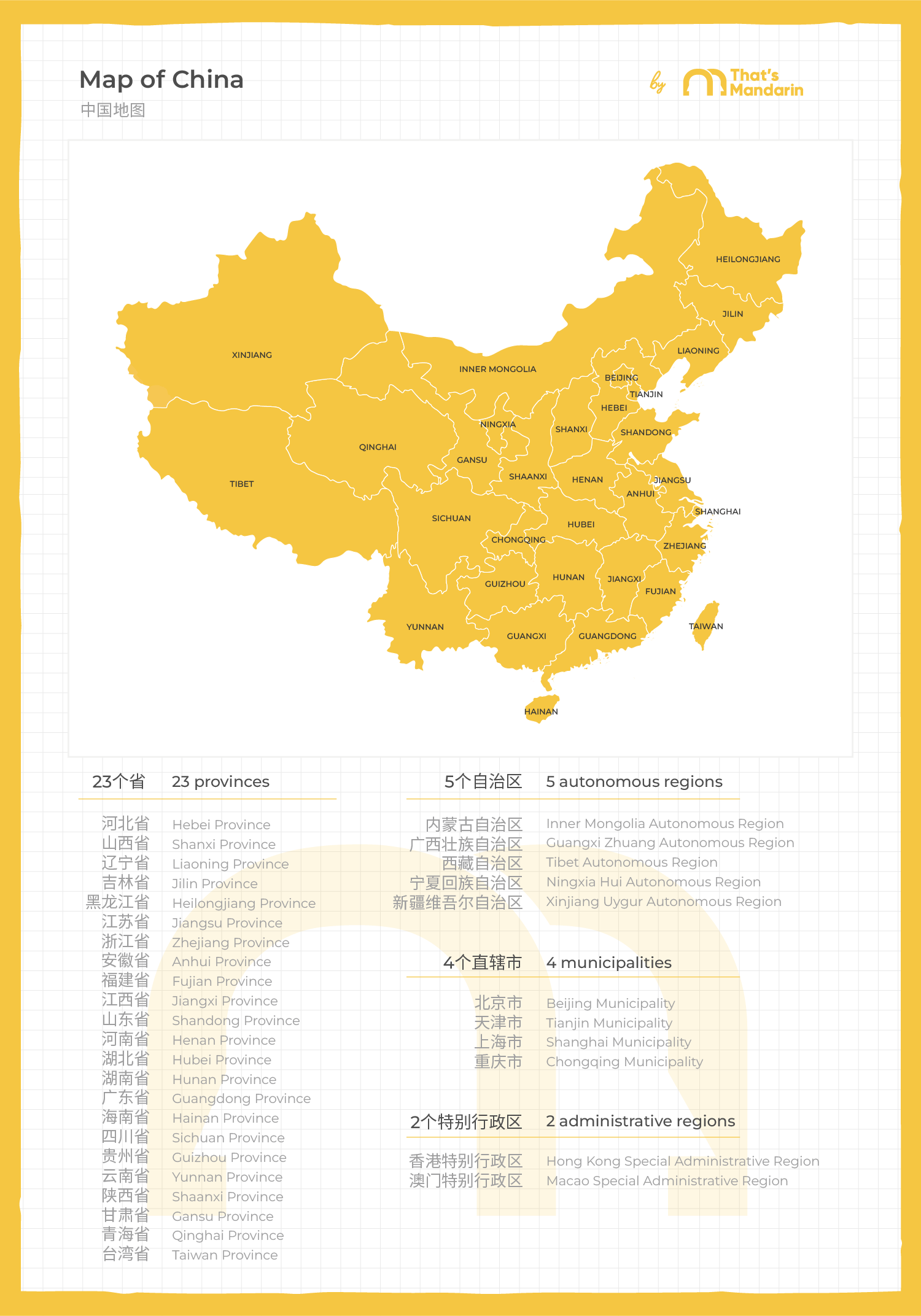
Provinces
There are 23 provinces in China’s administrative system. Provinces cover much of the country’s territory and are further divided into cities and other administrative areas.
Some of the best-known provinces include Guangdong, Sichuan, Yunnan, Zhejiang, Jiangsu and Shaanxi.
It’s useful to remember that a province isn’t necessarily defined by one particular type of landscape. A single province can contain mountains, plains, cities and rural areas.
Autonomous Regions
China has 5 autonomous regions:
- Guangxi
- Inner Mongolia
- Ningxia
- Xinjiang
- Tibet
They are province-level administrative divisions associated with areas where particular ethnic minority groups have historically lived in significant numbers.
Municipalities
China has 4 directly administered municipalities:
- Beijing
- Shanghai
- Tianjin
- Chongqing
These are unusual because they function as province-level divisions while also being major cities.
This is why you’ll sometimes see Beijing or Shanghai described as both a city and a province-level administrative division.
Special Administrative Regions
China has 2 Special Administrative Regions (SARs):
- Hong Kong
- Macau
They have distinct administrative systems and legal arrangements compared with mainland China.
Together, these four categories make up China’s 34 province-level administrative divisions.
Major Cities in China
China has many large cities, but they are not evenly distributed across the country. Most of the country’s biggest urban centres are concentrated in the east and southeast, where flatter terrain, major rivers, coastal access and established trade routes have supported large populations.
| city | province-level division | why it’s important |
|---|---|---|
| Beijing | Municipality | China’s capital and political centre |
| Shanghai | Municipality | Major financial and commercial centre |
| Guangzhou | Guangdong Province | Major southern economic and trading hub |
| Shenzhen | Guangdong Province | Technology, manufacturing and innovation centre |
| Chengdu | Sichuan Province | Major city and economic centre in Southwest China |
| Chongqing | Municipality | Major inland city and transport hub |
| Xi’an | Shaanxi Province | Historic city and important centre in Northwest China |
| Wuhan | Hubei Province | Major transport and economic centre in Central China |
| Hangzhou | Zhejiang Province | Major technology, business and cultural centre |
| Nanjing | Jiangsu Province | Historic city and major centre in eastern China |
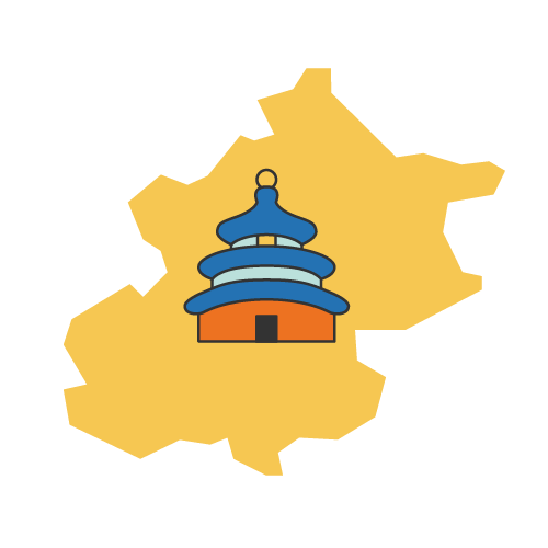
Beijing
Beijing (北京) is located in northern China and serves as the country’s capital. Its position near the northern edge of the North China Plain has made it strategically important throughout Chinese history.
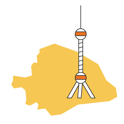
Shanghai
Shanghai (上海) sits on China’s eastern coast at the mouth of the Yangtze River. Its coastal location helped it develop into one of China’s most important financial, commercial and international cities.
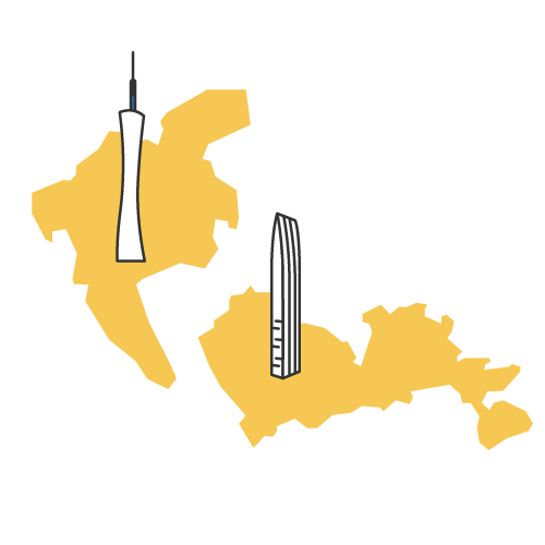
Guangzhou and Shenzhen
Both cities are in Guangdong, in southern China.
Guangzhou (广州) has long been an important centre for trade in the Pearl River region, while nearby Shenzhen (深圳) developed rapidly into a major technology and manufacturing hub.

Chengdu
Chengdu (成都) is the capital of Sichuan and one of the major cities of Southwest China. It sits in the fertile Sichuan Basin, which has helped support a large population despite the mountainous terrain surrounding the region.
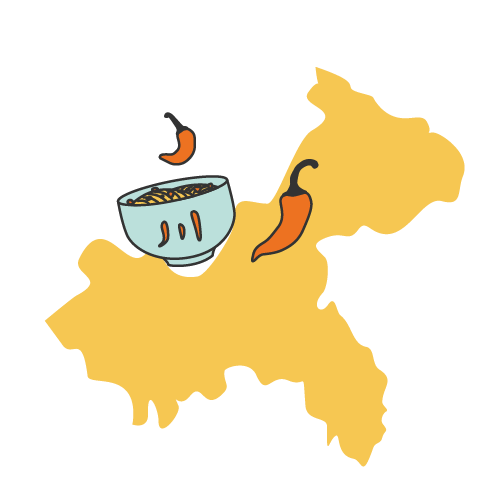
Chongqing
Chongqing (重庆) is a directly administered municipality in Southwest China. Built around the confluence of major rivers, its inland location has made it an important transport and industrial centre.
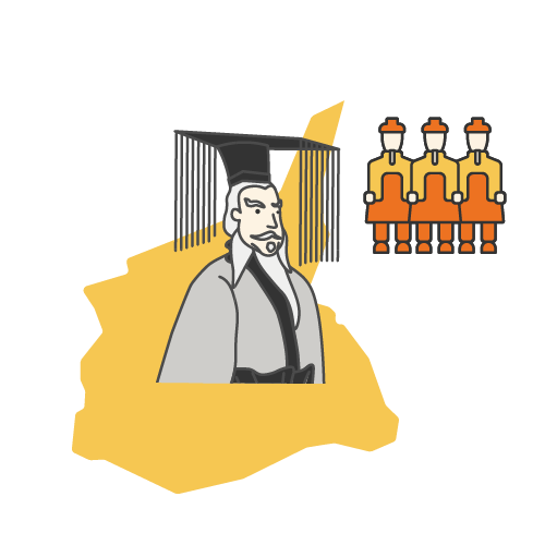
Xi’an
Xi’an (西安) is located in central-northwest China and was the capital of several ancient Chinese dynasties. Its position also made it an important starting point and eastern gateway of the historical Silk Road.
Wuhan
Wuhan (武汉) lies along the Yangtze River and at the intersection of several major transport routes. Its central location has helped it develop into an important transport and economic hub.
Hangzhou
Hangzhou (杭州) is located in eastern China. It sits near the Yangtze River Delta and is known for its technology and business industries.
Nanjing
Nanjing (南京) is also located in eastern China. It has a long history as a major political and cultural centre.
The locations of Nanjing and Hangzhou show a broader pattern in Chinese geography: major rivers, fertile plains, coastal access and transport routes have all played a role in where China’s largest urban centres developed.
China’s Mountains, Rivers and Deserts
China’s geography is shaped by some of the largest and most varied natural features in Asia. Mountains, rivers and deserts don’t just define the landscape; they have also influenced where people settled, how agriculture developed and how different parts of the country were connected.

Major Mountain Ranges
The Himalayas form part of China’s southwestern landscape and include Mount Everest, which sits on the border between China and Nepal.
Further north, the Kunlun Mountains extend across parts of western China, while the Tian Shan range stretches through Central Asia and into Xinjiang.
The Qinling Mountains are particularly important within China because they form a natural geographical divide between northern and southern parts of the country. The range also influences differences in climate, agriculture and vegetation between the two regions.
Major Rivers
China has several major river systems, but two are particularly important to its geography and history.
The Yangtze River (长江, Cháng Jiāng) is the longest river in China. It flows from the Tibetan Plateau through central China before reaching the East China Sea near Shanghai.
The Yellow River (黄河, Huáng Hé) flows through northern China and has been closely connected with the development of early Chinese civilisation. Its basin contains some of China’s most important historical agricultural areas.
The Pearl River system is also significant, particularly in southern China. It flows through the densely populated Pearl River Delta, where major cities including Guangzhou, Shenzhen and Hong Kong are located.
Deserts
China’s northern and western regions contain several large desert areas.
The Gobi Desert stretches across northern China and southern Mongolia, while the Taklamakan Desert lies in the Xinjiang Uyghur Autonomous Region.
These dry landscapes are very different from China’s humid eastern and southern regions. Their presence also helps explain why population density is generally much lower across large parts of western China.
China Geography Facts
China’s geography is full of contrasts. Here are some of the most useful facts to remember:
- China covers roughly 9.6 million square kilometres, making it one of the world’s largest countries by land area.
- The Tibetan Plateau is the highest and one of the largest plateaus in the world.
- Mount Everest lies on China’s border with Nepal, with its northern face located in Tibet.
- The Yangtze River is the longest river in China and flows into the East China Sea.
- The Yellow River is one of the most historically important rivers in China and is closely connected with the development of early Chinese civilisation.
- The Gobi Desert extends across northern China and southern Mongolia.
- The Taklamakan Desert is located in Xinjiang in western China.
- Beijing, Shanghai, Tianjin and Chongqing are cities that also have province-level administrative status.
- China’s largest population centres are concentrated primarily in the eastern and southeastern parts of the country.
- China officially uses one standard time zone, despite spanning a huge distance from east to west.
These contrasts are part of what makes China’s geography so distinctive: the same country contains high-altitude plateaus, enormous deserts, fertile river basins and some of the world’s largest urban centres. There is also the world wonder, the Great Wall. If you’re planning to visit the wall, our Great Wall of China visiting guide covers the main sections, how to get there and what to expect.
Chinese Geography Vocabulary
If you’re learning Mandarin, knowing a few basic geography terms can make maps, travel information and conversations about China much easier to follow.
| english | chinese | pinyin |
|---|---|---|
| China | 中国 | Zhōngguó |
| geography | 地理 | dìlǐ |
| map | 地图 | dìtú |
| province | 省 | shěng |
| city | 城市 | chéngshì |
| mountain | 山 | shān |
| river | 河 / 江 | hé / jiāng |
| lake | 湖 | hú |
| desert | 沙漠 | shāmò |
| coast | 海岸 | hǎi’àn |
| north | 北方 | běifāng |
| south | 南方 | nánfāng |
| east | 东方 | dōngfāng |
| west | 西方 | xīfāng |
One useful detail is that Chinese uses both 河 (hé) and 江 (jiāng) for rivers. You’ll often see 江 used in the names of major rivers in southern and central China, such as 长江 (Cháng Jiāng) for the Yangtze River.